
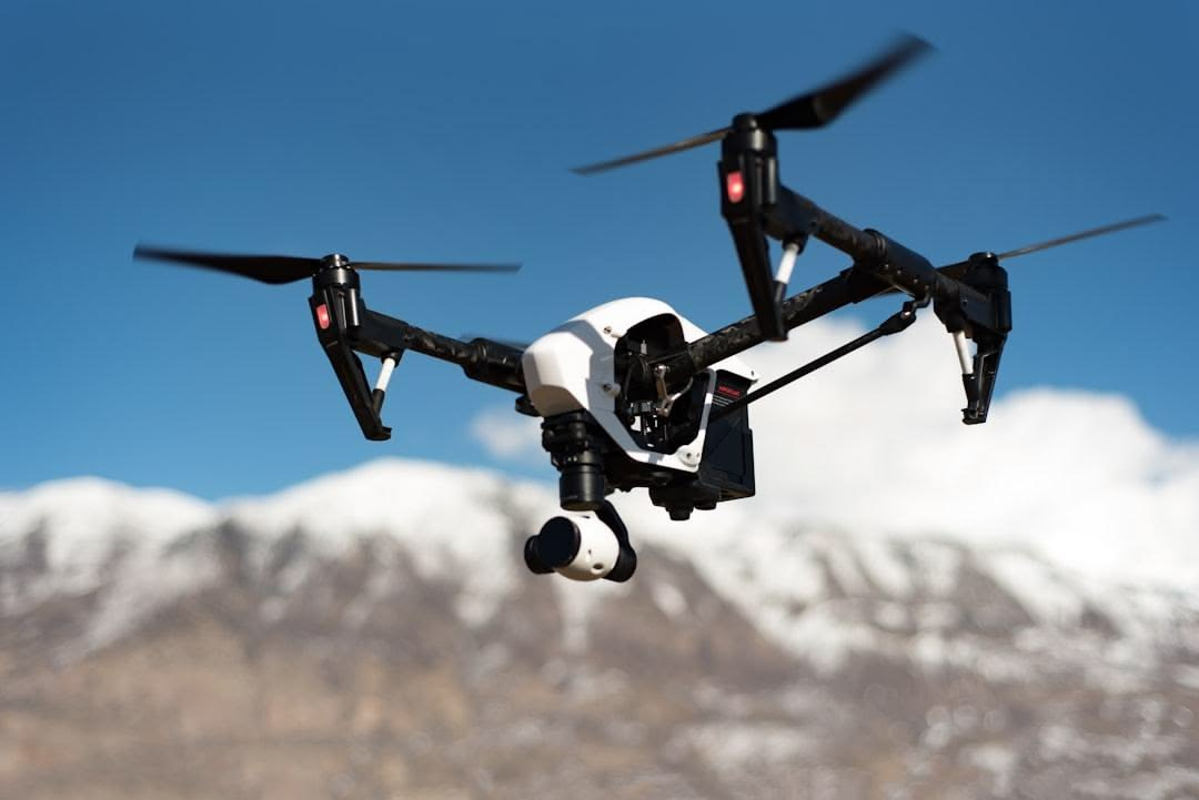
As technology continues to evolve rapidly, drones have become indispensable tools in modern surveying, transforming how professionals collect, analyze, and interpret spatial data. In 2026, surveying drones are no longer just aerial cameras—they are advanced geospatial instruments equipped with high-precision GPS systems, intelligent flight automation, LiDAR and photogrammetry capabilities, and ultra-high-resolution imaging sensors that deliver survey-grade accuracy in real time. These innovations have significantly improved efficiency by reducing fieldwork time, enhancing safety in hard-to-reach or hazardous areas, and delivering more consistent and detailed mapping results than traditional ground-based methods.
Across industries such as construction, mining, agriculture, urban planning, and environmental monitoring, the demand for reliable and high-performance surveying drones continues to grow. Professionals now prioritize drones that offer longer flight times, stable wind resistance, centimeter-level positioning accuracy, intelligent route planning, and seamless integration with mapping and CAD software. Features such as obstacle avoidance, RTK/PPK positioning, and advanced imaging systems have become essential for ensuring data precision and operational efficiency in complex surveying environments.
Whether you’re conducting topographic mapping, infrastructure inspections, land subdivision planning, or environmental assessments, the right drone can dramatically improve workflow speed, accuracy, and cost-effectiveness. In this guide, we explore the best drones for surveying in 2026, highlighting top-performing models known for their exceptional camera quality, GPS precision, endurance, and professional-grade reliability to help you choose the ideal tool for your surveying needs.
1. DJI Mavic 3 Enterprise
The DJI Mavic 3 Enterprise stands out as one of the most advanced and reliable surveying drones for professionals in 2026, offering a powerful combination of precision imaging, extended flight performance, and intelligent flight control. Designed specifically for enterprise and industrial applications, it represents a major step forward from earlier models like the DJI Phantom 4, particularly in terms of imaging stability and data accuracy required for professional surveying tasks.
One of its most valuable features is the mechanical shutter, which significantly reduces motion blur and distortion caused by fast movement—an essential advantage when capturing accurate geospatial data during flight. Unlike drones that rely on rolling shutters, the Mavic 3 Enterprise ensures sharper, more consistent image capture, making it highly suitable for mapping, land assessment, and infrastructure inspections.
In addition to its imaging capabilities, the drone offers an impressive flight time of up to 45 minutes, allowing surveyors to cover larger areas in a single mission without frequent battery changes. Powered by a Micro Four Thirds sensor, it delivers exceptional image clarity, rich detail, and strong low-light performance, making it reliable even in challenging environmental conditions.
Overall, the DJI Mavic 3 Enterprise is built for professionals who demand accuracy, efficiency, and dependable performance in every flight, making it a top-tier choice for surveying, mapping, and industrial drone applications.

Specifications
✔ Camera System (Hasselblad Main Camera) – Equipped with a legendary Hasselblad-engineered camera that delivers exceptional color accuracy, dynamic range, and professional-grade aerial image quality for surveying and mapping applications.
✔ Tele Camera with Pro Mode – Includes a powerful telephoto camera that supports Pro Mode, allowing manual control of camera settings and RAW image capture for advanced post-processing and highly detailed survey outputs.
✔ Sensor Type – Large-format imaging sensor designed to capture high-resolution aerial imagery with superior clarity, sharpness, and detail retention, even in complex environments.
✔ Adjustable Aperture (f/2.8–f/11) – Variable aperture system allows flexibility across lighting conditions; wide f/2.8 aperture enhances low-light performance while narrower settings improve depth control and exposure precision.
✔ Lens Field of View (FOV) – 24mm equivalent lens with an 84° field of view, enabling wider scene coverage for efficient mapping, surveying, and environmental documentation.
✔ Autofocus Technology (VDAF – Vision Detection Auto Focus) – Advanced multi-sensor focusing system that uses visual and distance data to deliver faster, more accurate focusing performance during flight.
✔ Obstacle Sensing System – Omnidirectional obstacle detection ensures full 360° environmental awareness, improving flight safety and reducing collision risks during complex surveying missions.
✔ Return-to-Home Function (Smart RTH) – Intelligent navigation system that calculates the safest and most efficient return path, combining advanced RTH and traditional RTH for improved operational reliability.
✔ Live View Transmission – Supports FHD 1080p/60fps real-time video transmission, providing smooth, high-resolution live feed for precise flight control and real-time surveying feedback.
✔ Flight Performance – Stable and intelligent flight system designed for professional aerial operations, offering consistent performance in varying environmental conditions.
Pros
✔ Mechanical shutter eliminates motion blur – Ensures sharp, distortion-free images, making it highly suitable for precise aerial mapping, surveying, and photogrammetry work.
✔ Micro Four Thirds (4/3”) sensor delivers outstanding image quality – Produces highly detailed imagery with excellent dynamic range and strong low-light performance for professional-grade data capture.
✔ Extended 45-minute flight time – Allows longer missions and wider area coverage per flight, significantly improving efficiency during large-scale surveying projects.
✔ High-resolution imaging for professional outputs – Captures crisp, detailed photos that support accurate mapping, analysis, and reporting in engineering and geospatial applications.
✔ Improved accuracy compared to Phantom 4 series – Offers enhanced positioning, stability, and imaging precision, making it a more reliable tool for modern surveying and inspection workflows.
✔ Compact and foldable enterprise design – Easier to transport and deploy in the field compared to traditional bulky surveying drones, improving mobility and field efficiency.
✔ Enterprise-grade build quality and reliability – Designed for professional and commercial use, ensuring consistent performance in demanding environments and long-term operational durability.
Cons
❌ High price point limits accessibility – The premium cost makes it less suitable for hobbyists, beginners, or small-scale users who do not require enterprise-level surveying features.
❌ Primarily optimized for technical and professional use – Many advanced imaging and mapping features are designed for surveying and inspection workflows rather than casual or creative photography.
❌ Requires professional knowledge for full utilization – To fully benefit from its mapping, photogrammetry, and enterprise capabilities, users need training or experience in drone surveying and GIS workflows.
❌ Additional costs for software and accessories – Enterprise mapping tools, RTK modules, batteries, and specialized software can significantly increase the overall investment beyond the base drone price.
The DJI Mavic 3 Enterprise firmly positions itself as one of the most capable and reliable drones for professional aerial photography and surveying in 2026. Its standout combination of a mechanical shutter and a large Micro 4/3” sensor delivers consistently sharp, distortion-free images, even in fast flight conditions or when capturing expansive survey areas. This makes it especially valuable for applications where precision and visual accuracy are non-negotiable.
Beyond image quality, the drone’s strong low-light performance, extended flight time, and advanced imaging system allow professionals to operate efficiently across a wide range of environments. Whether used for mapping, infrastructure inspection, land surveying, or environmental documentation, it ensures dependable results with minimal compromise in image clarity or data consistency.
Compared to older platforms like the Phantom 4, the Mavic 3 Enterprise represents a major leap forward in both performance and practicality. It offers improved portability, smarter flight systems, and significantly higher imaging precision, making field operations faster and more efficient without sacrificing quality.
Overall, the DJI Mavic 3 Enterprise is a top-tier solution for professionals who require accurate, high-resolution aerial photography and dependable surveying performance. It is not just an upgrade it is a modern, enterprise-grade tool built for serious work where precision, reliability, and efficiency truly matter.

2. DJI Matrice 350 RTK
The DJI Matrice 350 RTK is a high-performance commercial drone designed for professional surveyors and drone pilots who require accuracy, reliability, and efficiency in geospatial data collection. It is widely used in surveying, mapping, construction monitoring, and infrastructure inspection due to its ability to deliver precise and consistent results in complex environments.
The drone is built for versatility, supporting up to three payloads at once, each with a capacity of up to six pounds. This allows surveyors to integrate multiple sensors such as RGB cameras, LiDAR, or multispectral systems in a single mission, improving efficiency and reducing the need for repeated flights.
It also offers strong operational performance, with a flight time of up to 55 minutes and a transmission range of up to 9.3 miles (approximately 15 kilometers) with triple-channel 1080p video. This ensures reliable long-range coverage and stable communication, even during large-scale surveying missions.
For precision work, the M350 RTK can reach speeds of up to 51.5 mph (23 m/s) and uses a global mechanical shutter to reduce image blur. Its RTK system delivers centimeter-level accuracy 1.5 cm + 1 ppm vertically and 1 cm + 1 ppm horizontally achieving up to 3 cm accuracy without ground control points. Its swappable payload system further enhances flexibility, allowing customization for different surveying needs.

Specifications
✔ Special Features: Includes long-distance control, 4K HDR video recording, wind resistance, lightweight and foldable design, compact portability, one-button return, and extended flight time for convenient aerial operations.
✔ Video Capture Resolution: Records ultra-clear 4K video, delivering professional-grade aerial footage suitable for content creation and surveying.
✔ Effective Still Resolution: Offers 48MP high-resolution photography for detailed and sharp aerial images.
✔ Connectivity Technology: Uses Bluetooth and Wi-Fi for stable, fast, and reliable device pairing and control.
✔ Skill Level: Designed for all users, from beginners to advanced drone operators.
✔ Battery Capacity: Equipped with a 2453 mAh battery, optimized for balanced flight performance and efficiency.
✔ Video Capture Format: Records in MP4 format for easy editing, sharing, and compatibility across platforms.
✔ Remote Control Technology: Operates via Wi-Fi-based remote control for responsive and stable flight management.
✔ Control Type: Comes with a dedicated remote control for precise navigation and flight handling.
✔ Maximum Range: Supports up to 10 km transmission range for extended and reliable flight coverage.
✔ Wireless Communication Technology: Utilizes Wi-Fi for consistent and smooth data transmission.
✔ Battery Cell Composition: Powered by Lithium-Ion cells for reliable energy storage and long-term durability.
Pros
✔ The RTK positioning system delivers centimeter-level accuracy, making it highly reliable for professional surveying and mapping applications.
✔ It supports up to three payloads simultaneously, each weighing up to 6 lbs, offering exceptional versatility for different surveying missions.
✔ It provides up to 55 minutes of flight time, making it ideal for large-area surveys and long-duration field operations.
✔ It features triple-channel 1080p transmission with a range of up to 15 km (9.3 miles), ensuring stable and reliable long-distance communication.
✔ It uses a global mechanical shutter that minimizes motion blur, ensuring sharp and accurate data capture even during fast flights.
✔ It achieves a high flight speed of up to 51.5 mph (23 m/s), improving efficiency in time-sensitive surveying and mapping projects.
✔ It comes with a modular and swappable payload system, supporting cameras, LiDAR, thermal, and multispectral sensors for flexible data collection.
Cons
❌ Very expensive, making it suitable mainly for commercial and enterprise operators with larger budgets.
❌ Large and heavy platform, which reduces portability compared to smaller consumer-grade drones.
❌ Steeper learning curve, requiring trained and experienced pilots for safe, efficient, and compliant operation.
❌ Payloads are sold separately, which significantly increases the overall total investment cost.
The DJI Matrice 350 RTK stands out as a highly advanced and reliable aerial platform designed for professionals who demand both precision and efficiency in aerial photography, mapping, and surveying tasks. Its integration of RTK positioning technology and a global mechanical shutter ensures consistently sharp, distortion-free imagery with centimeter-level accuracy, even in fast and complex flight operations.
Its greatest strength lies in its exceptional versatility, allowing multiple payloads to be used simultaneously. This enables professionals to capture a wide range of geospatial data—including high-resolution imagery, LiDAR scans, thermal data, and multispectral outputs—in a single mission, significantly improving workflow efficiency and data accuracy.
With long flight endurance, stable long-range transmission, and enterprise-grade performance, the M350 RTK is built for demanding field environments. It is especially suited for large-scale surveying, infrastructure inspection, land development, and professional aerial photography projects where reliability, precision, and operational efficiency are critical for success.

3. Autel EVO II Pro RTK V3
The Autel EVO II Pro RTK V3 is a powerful mid-range aerial solution designed specifically for professionals involved in photogrammetry, mapping, and surveying. It combines advanced imaging capabilities with RTK-level positioning accuracy, making it a reliable tool for projects that require both precision and operational flexibility.
One of its key strengths is its lightweight and portable design, weighing approximately 2.8 pounds (1250 grams). This makes it significantly easier to transport and deploy in the field compared to heavier enterprise drones, without sacrificing performance or data quality. Its compact structure allows surveyors to operate efficiently across multiple locations with minimal logistical effort.
In terms of performance, the EVO II Pro RTK V3 offers a flight time of up to 38 minutes, supported by a stable airframe capable of handling level 8 wind resistance. This ensures reliable operation even in challenging environmental conditions, making it suitable for outdoor surveying tasks where weather variability is a concern.
For data capture, the drone is equipped with a 1-inch CMOS sensor capable of recording 6K ultra-high-definition imagery, delivering sharp and detailed visual data for mapping and analysis. Combined with a transmission range of up to 9.3 miles (15 kilometers) and an integrated RTK module, it ensures centimeter-level positioning accuracy and consistent, high-quality geospatial data collection.
Specifications
✔ Compatibility: Designed specifically for Autel EVO II Pro RTK V3 and EVO II series drones for seamless integration and stable operation.
✔ Functionality: Supports remote airdrop operations for advertising, bait delivery, gift dropping, meal delivery, and controlled payload release applications.
✔ Control Method: Operates via drone flight software, allowing simple and efficient activation through the aircraft’s down-view light control system.
✔ Interface: Equipped with a Type-C charging interface for fast, convenient, and universal charging.
✔ Battery Capacity: Built-in 150mAh battery supports multiple release operations per charge cycle for extended field use.
✔ Charging Time: Fully charges in approximately 90 minutes for quick turnaround between missions.
✔ Operational Efficiency: Capable of approximately 300 opening and release cycles on a single full charge.
✔ Material Build: Constructed from durable ABS material for lightweight strength and operational safety.
✔ Weight: Ultra-light design with a net weight of 51g, ensuring minimal impact on drone flight performance.
✔ Dimensions: Compact size measuring 9.6 × 10 × 4.8 cm for easy mounting and portability.
✔ Payload Safety Limit: Supports safe airdrop of items up to 500g to maintain stable flight performance and prevent overload risks.
Pros
✔ Lightweight and portable (2.8 lbs / 1250 g), making it easy to transport and deploy in fieldwork operations.
✔ Equipped with a 1-inch CMOS sensor capable of 6K video recording and high-resolution still photography for detailed aerial imaging.
✔ Built-in RTK module delivers centimeter-level positioning accuracy for professional surveying and mapping tasks.
✔ Supports Base Station RTK, Network RTK, and PPK workflows, offering flexible and efficient surveying operations.
✔ Provides up to 38 minutes of flight time, making it suitable for medium to large-scale mapping and surveying missions.
✔ Strong Level 8 wind resistance ensures stable flight performance and consistent image capture in challenging weather conditions.
✔ Offers a long transmission range of up to 15 km, enabling reliable long-distance control and data communication.
Cons
❌ Shorter flight time compared to heavier enterprise drones like the DJI Matrice series, limiting extended mission endurance.
❌ Camera sensor is smaller than Micro Four Thirds systems, reducing performance in low-light and ultra-detailed imaging scenarios.
❌ Limited payload flexibility since the camera system is not swappable, restricting multi-sensor professional workflows.
❌ Ecosystem and third-party software support is less extensive compared to DJI platforms, limiting advanced integration options for some enterprise users.
The Autel EVO II Pro RTK V3 stands out as a highly capable aerial imaging solution that effectively balances professional-grade accuracy, high-quality imaging, and field portability. It is specifically designed for photographers, surveyors, and mapping professionals who require reliable data capture without the complexity and bulk of larger enterprise systems.
Its combination of a 1-inch CMOS sensor and 6K imaging capability ensures consistently sharp, detailed, and low-noise visuals, making it highly suitable for photogrammetry, inspection work, and precision mapping tasks. When paired with its RTK and PPK positioning systems, it delivers accurate geotagging and dependable spatial consistency across all captured data.
Unlike heavier industrial drones, the EVO II Pro RTK V3 offers a more compact and portable workflow, enabling professionals to operate efficiently in diverse field conditions without compromising performance. Its ability to maintain enterprise-level accuracy in a lightweight design makes it a practical choice for fast deployment and multi-site operations.
Overall, the Autel EVO II Pro RTK V3 is an excellent option for professionals who value precision, image quality, and mobility in a single integrated platform, delivering strong performance across modern surveying and aerial photography applications.

5. AgEagle’s eBee X
The AgEagle eBee series, formerly developed under the senseFly brand, represents one of the most advanced fixed-wing drone platforms purpose-built for high-precision surveying, mapping, and geospatial data acquisition. Unlike multi-rotor drones, the eBee series is engineered specifically for long-range aerial missions where efficiency, endurance, and large-area coverage are critical. It is widely used by professional surveyors, GIS specialists, and engineering teams working on large-scale spatial data projects.
One of the most defining characteristics of the eBee series is its extended flight endurance combined with ultra-lightweight design. With a total weight of approximately 3.6 pounds (1.6 kg), these drones are easy to deploy in the field while still offering powerful operational capabilities. Their fixed-wing configuration allows them to glide efficiently through the air, enabling flight times of up to 90 minutes on a single battery. This makes them highly suitable for surveying vast terrains such as agricultural land, mining sites, infrastructure corridors, and environmental monitoring zones.
In terms of data precision, the eBee platform is designed to meet professional-grade surveying standards. It delivers absolute accuracy ranging from 0.6 to 1.5 cm, depending on configuration and workflow conditions. The system supports both RTK (Real-Time Kinematic) and PPK (Post-Processed Kinematic) workflows, allowing surveyors to achieve highly accurate geospatial outputs even in challenging environments where ground control points may be limited or difficult to deploy.
Additionally, the eBee series is built with modular payload flexibility, enabling users to adapt the platform for different mission requirements. It supports a range of advanced sensors, including the SODA 3D mapping camera, Parrot Sequoia multispectral sensor, and compatible third-party payloads. This versatility makes it a powerful tool for diverse applications such as orthomosaic mapping, precision agriculture, infrastructure inspection, and environmental analysis, all within a single integrated aerial system.

Specifications
✔ Special features include 360-degree flips, auto follow mode, compact design, extended flight time, and FPV (First Person View) for immersive flying experience.
✔ It supports 720p video capture resolution, delivering basic HD-quality aerial footage suitable for beginners.
✔ Connectivity technology uses Wi-Fi for wireless control and real-time video transmission.
✔ It is designed for beginner skill level users, making it easy to operate and learn.
✔ The battery has a 1600 mAh capacity, providing sufficient power for stable short-to-medium flights.
✔ Remote control technology uses infrared (IR) signals for simple and responsive drone operation.
✔ It has a maximum control range of up to 600 feet for close-to-medium distance flying.
✔ The battery uses Lithium-Ion cell composition for reliable and rechargeable performance.
✔ It is not compatible with smart home systems as it is designed purely for aerial use.
✔ Additional details include beginner-friendly controls and compact design for easy portability and use.
Pros
✔ Exceptional flight time (up to 90 minutes), making it highly suitable for large-area mapping and extended surveying missions.
✔ Fixed-wing design enables highly efficient coverage of hundreds of hectares in a single flight with reduced energy consumption.
✔ High absolute accuracy (0.6–1.5 cm), delivering professional-grade and highly reliable survey outputs.
✔ Full support for RTK and PPK workflows, ensuring precise georeferencing and improved data accuracy.
✔ Lightweight build (1.6 kg / 3.6 lbs), making it easy to transport, deploy, and operate in the field.
✔ Swappable payload system supports RGB, multispectral, and third-party sensors for flexible mission requirements.
✔ Proven platform widely trusted by commercial surveyors and mapping professionals for high-end geospatial projects.
Cons
❌ No vertical takeoff and landing (VTOL), requiring sufficient open space for hand launch and belly landing operations.
❌ Not suitable for cinematic photography or close-range inspection work due to its fixed-wing flight design.
❌ Higher learning curve compared to multirotor drones, requiring trained pilots for effective mission planning and operation.
❌ Premium pricing, especially when advanced RTK/PPK setups and specialized payloads are included, increasing overall investment cost.
The AgEagle eBee X is a highly specialized surveying platform designed to deliver maximum efficiency, accuracy, and coverage for large-scale geospatial projects. Its fixed-wing architecture and extended 90-minute flight endurance make it exceptionally effective for mapping vast terrains in a single mission, significantly improving operational productivity while reducing overall field time and costs.
Its strength is further reinforced by its centimeter-level accuracy combined with RTK and PPK capabilities, ensuring highly reliable and survey-grade data output. The ability to integrate interchangeable payloads such as RGB, multispectral, and advanced mapping sensors allows professionals to adapt the system to a wide range of applications, including topographic surveys, precision agriculture, environmental monitoring, and infrastructure development.
Overall, the eBee X stands out as a trusted solution for organizations that prioritize large-area coverage, high-precision data, and efficient aerial workflows. It remains one of the most dependable tools in modern surveying, offering a balance of endurance, accuracy, and professional-grade mapping performance.
Frequently Asked Questions (FAQs)
1. What is the best surveying drone in 2026?
The best choice depends on your needs, but the DJI Matrice 350 RTK, DJI Mavic 3 Enterprise, and AgEagle eBee X are among the top options.
2. What does RTK mean in drone surveying?
RTK (Real-Time Kinematic) improves GPS accuracy to the centimeter level for precise mapping and surveying.
3. What is the difference between RTK and PPK?
RTK provides corrections during flight, while PPK applies corrections after the flight during data processing.
4. Which drone is best for large-area mapping?
The AgEagle eBee X is ideal due to its fixed-wing design and up to 90-minute flight time.
5. Why is a mechanical shutter important?
It reduces motion blur and image distortion, resulting in more accurate mapping data.
6. Can surveying drones work without ground control points (GCPs)?
Yes, RTK and PPK drones can often achieve high accuracy with few or no GCPs.
7. What camera resolution is best for surveying?
A 20MP to 48MP camera is generally sufficient for high-quality mapping and photogrammetry.
8. Which drone has the longest flight time?
The AgEagle eBee X offers up to 90 minutes of flight time.
9. What industries use surveying drones?
Construction, mining, agriculture, land surveying, infrastructure inspection, and environmental monitoring.
10. Are surveying drones difficult to fly?
Most modern surveying drones feature automated flight planning, making them easier to operate.
Conclusion
Choosing the right surveying drone can significantly improve the accuracy, efficiency, and overall success of your mapping projects. Whether you need the versatility of the DJI Matrice 350 RTK, the portability of the Autel EVO II Pro RTK V3, or the large-area coverage capabilities of the AgEagle eBee X, today’s professional drone platforms offer powerful solutions for a wide range of surveying applications.
The best drone for your needs will depend on factors such as project size, required accuracy, sensor compatibility, flight endurance, and budget. Investing in a drone equipped with RTK or PPK technology can help streamline workflows, reduce field time, and deliver highly accurate geospatial data with confidence.
As drone technology continues to evolve, professional surveyors, engineers, and mapping specialists have more advanced tools than ever before. By selecting a platform that aligns with your operational requirements, you can increase productivity, improve data quality, and stay competitive in the rapidly growing geospatial industry.
